In 2008, the 17th Street levee at the National Mall was considered a flood risk.
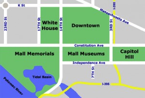
17th street connects the National Mall to the other areas of D.C. including the White House (map courtesy of visitingdc.com)
This summer, as construction comes to a close, some Washington residents are only just learning about the project to fix the levee.
The current flood levee on the National Mall is an earthen structure from the 1930s which protects against flooding from the Potomac River. Across 17th Street, a removable section of the levee is made of concrete barriers which are reinforced with sandbags in the event of flooding. The last time this action was taken was after Hurricane Isabel in 2003.
After Hurricane Katrina, the Army Corps of Engineers evaluated levees across the country, and the levee at 17th Street was deemed unsatisfactory. The Federal Emergency Management Agency then declared that much of the District of Columbia was in a flood plain –requiring large parts of the city to buy expensive flood insurance.
“Notice of the need to fix the levee didn’t come through until 2008,” said Julia Koster at the National Capital Planning Commission. “When the Corps said this levee didn’t meet our standards, FEMA said if the levee didn’t hold where would the flooding go?”
According to the Associated Press, the Corps estimated that a major storm could cause up to $200 million in damages to museums, memorials and other federal office buildings.
The planning period for fixing the levee took until mid-2010. Because of the historic nature of the national Mall and the number of monuments and memorials, Koster said changes to the Mall usually take 5-10 years. In comparison, the flood levee reviews proceeded at a very rapid pace.
“Building anything on the mall requires extensive review,” Koster said. “It has to be something that is seamless, aesthetically pleasing.”
The other part of the problem was money. A multi-billion dollar project was needed, and the funds had not been built into anyone’s budget. And the project fell under multiple jurisdictions.
The levee is on National Park Service property. Levees are handled by the Army Corps of Engineers. The flood zone was declared by FEMA.
The result was an example of interagency partnership. The District of Columbia got the ball rolling by pumping $2.8 million into the project.
“The District took on the task at the time of initiating the funding of a new levee system when it appeared that no federal dollars for the project would be provided before the new flood maps took effect,” said Tayna Washington at the D.C .Office of Planning.
The National Park Service contributed $700,000. When stimulus money was released, the Army Corps of Engineers, the lead agency on the project, gave Hirani Engineering and Land Survey P.C. in New York $4.6 million to build the project. An additional $1.5 million came from the National Park Service for stone cladding on levee walls, helping it match the rest of the mall.
The project was originally scheduled to start in October 2010 but in November, the AP was still projecting that construction would start soon. Still, the slight delay does not seem to have affected the completion date for the project.,
“Work is progressing,” said William Line at the National Park Service, who said the project is still scheduled to be completed by late summer or September.
“There’s nothing new to that,” Line said. “What it’s affecting is the ability to move.”
The National Park Service provides weekly traffic updates to alert citizens to traffic congestion caused by the construction.
Despite alerts, some citizens were surprised by the construction when summer recreation resumed.
“Honestly, I hadn’t even been aware of what was happening,” said Jackie Linnane, who lives in the Eastern Market neighborhood, just off Capitol Hill. “Our [kickball] team saw a wall one day, but we weren’t sure why it had been constructed. There were no signs, nothing to indicate its purpose that we could see.”
Linanne said the construction is making it harder for those using the area for recreation to find enough space.
“We were competing for space before there were any ‘off limits’ areas. Now it’s getting even more fierce,” Linanne said. “It’s already proven to be problematic to our playing space, but I understand if they’re trying to prevent possible flooding.”
But recreation and traffic are not the only things affected.
“The District actually struck an unusual arrangement with FEMA to quickly move to entitle the new levee closure at 17th Street and begin its construction, while FEMA held off publishing the new flood maps,” said Washington, “hoping to get the new protection in place before the new flood plain designation would have affected federal and local buildings, insurance requirements, and construction codes.”
But construction did not meet some FEMA deadlines, and some areas of the city have been forced to buy flood insurance until the levee is complete.
“There are hundreds of such properties in Southwest that also will be protected from flooding by the levee,” said Washington. “These properties were added to the flood map for the first time last September. Once the levee is constructed, those properties will be removed from the flood map.”
Still, Koster said the project has been an overall success for those involved.
“It was a really good example of a partnership effort,” Koster said.